
Walk Las Vegas Street Directory
An address-based search begins with a physical place, then adds the records that share its parcel key. The Clark County Assessor is the first official stop because it returns the APN, situs address, mailing address, legal description, and City or Unincorporated Town field. GIS confirms where the parcel sits and what it touches. The Recorder then supplies recorded parties and instruments tied to the APN or legal description. A street directory should not be treated as a complete list of people at every door. It is a careful route through land and record relationships.
- Enter the address in the Assessor search. Preserve the street number, direction, name, type, city or town, APN, situs, and mailing address separately.
- Open the same location in Clark GISMO or the City parcel services. Confirm jurisdiction, parcel geometry, ZIP, and nearby parcel boundaries.
- Use the APN in AcclaimWeb Parcel Search. Compare the recorded parties, instrument type, record date, and legal description with the Assessor card.
- For an older owner trail, search the seller or prior grantee backward and move to Recorder microfilm or the public research counter when the 1988 online index ends.
- For historical occupants, ask Cahlan, UNLV, the Library District, or FamilySearch whether a specific reverse or criss-cross volume supports the address and year.
Note: Preserve the exact directional prefix, street type, unit, and APN because a shortened address can lead to a different parcel.
Normalize Las Vegas Street Addresses
Las Vegas addressing depends on direction and street type. City Planning identifies Main Street and Fremont Street as the local grid origins, with direction and parity carrying information in the adopted system. Historic records may use a different numbering pattern, a former street name, or a postal city line that does not match the current government jurisdiction. Preserve the original wording first, then normalize it for the current search form.
- APN
- The Assessor Parcel Number, an 11-digit key used to connect the property card, map, and Recorder search.
- Situs address
- The physical parcel location used by the Assessor. It is different from the owner’s mailing address.
- Plat
- A recorded map that lays out lots, blocks, and subdivisions, often more stable than an old street number.
- Criss-cross directory
- An address-to-name directory, if the particular volume supports reverse lookup. A normal alphabetical directory may not.
When a name or number has changed, compare the legal description with UNLV street files, the indexed 1957 to 1961 R. L. Polk Arrow map, or Sanborn map references. A no-hit is often a clue to examine the old address form, not a reason to discard the record.
Las Vegas Assessor Street Search
The Clark County Assessor Real Property Records form is built for precise street work. Street Name is required. Street Number is optional, and the portal states that a supplied number can return addresses within three blocks. Direction, type, and City or Town use portal controls. Omit City or Town if it is uncertain because that field refers to the legal boundary, not simply the mailing city. The form also offers phonetic matching and a choice between a current parcel record or present and prior owners.
| Street-search field | Required? | Las Vegas use |
|---|---|---|
| Street Number | No | Use the numeric number when known; results can include nearby addresses within three blocks. |
| Street Direction | No | Keep the directional part of the address because it can distinguish locations. |
| Street Name | Yes | Use the exact current spelling or test a documented historical variant. |
| Street Type | No | Select the portal’s street-type option when it is known. |
| City or Town | No | Use for a verified legal jurisdiction, not an assumed postal city. |
| Record preference | No | Choose current parcel data or present and prior owners of the parcel. |
The official Assessor menu, including owner, address, APN, subdivision, NAMS, map/page, parcel map, and GIS options, is visible at the property search source.
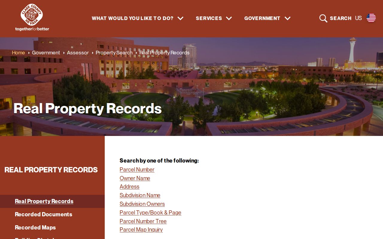
Once the parcel detail opens, save its owner and mailing field, location address, APN, legal description, recorded-document number, and jurisdiction field before moving to a map or deed search.
Las Vegas GIS Parcel Browsing
The Clark County GISMO Open Web supplies the spatial half of a street search. It offers Assessor, zoning, planned-land-use, imagery, and related layers. City GIS services add parcel, ZIP, jurisdiction, precinct, and ward data. In the City Planning map route, enter a directional address or an APN without dashes, select the result, and inspect the parcel popup. The popup can identify jurisdiction, lot size, ownership, zoning, prior case history, and other planning fields.
For a street segment, click the target parcel, record its APN and jurisdiction, then inspect adjacent polygons one at a time. County and city REST services support identify and spatial queries, but the inspected public materials did not establish a consumer-facing bulk street export or a named map-buffer control. GIS data is display-only and can lag the Assessor. Match every map result to the current property card before relying on an owner attribute.
Note: Record the map access date because a parcel layer can lag the current Assessor card or a recently recorded instrument.
Las Vegas Street Records by Address
Street-level research works best as an address chain. The Assessor card identifies the parcel. GIS resolves its geometry and jurisdiction. The Recorder documents recorded instruments. City permit and code materials can add dated address evidence, while libraries may hold a historical directory or newspaper notice. The sources reveal different facts, and none independently establishes every person connected to a street address.
| Address source | What it can show | Las Vegas access route | Key limit |
|---|---|---|---|
| Assessor address search | Current or prior parcel owner, situs, mailing address, APN, and property facts | Free online card, office, or phone | Property administration record, not a household roster |
| GISMO and City parcel layers | Parcel geometry, jurisdiction, ZIP, zoning, and adjacent parcels | Free map and REST services | Display data must be matched to the Assessor |
| Recorder parcel search | Recorded parties, document type, date, instrument, and legal description | AcclaimWeb index, copies, or public counter | Online official-record coverage begins in 1988 |
| Permit and code routes | Address-related work or case clues | City or county custodian by jurisdiction | Published search fields and history cutoffs were not verified |
| Voter services | Narrow registration confirmation where allowed | Individual service or permitted statutory file route | No ordinary public whole-street search |
A postal Las Vegas address alone cannot select the correct office. Check CityLimits, Place, or the Assessor’s City or Unincorporated Town field before using the City permit route instead of the county route.
Las Vegas APNs and Deed Chains
Use the APN as the bridge from a mapped parcel to the Recorder’s AcclaimWeb index. Search the parcel number first, then narrow by instrument type or date when several records appear. The index can provide principal party names, document type, recording date, instrument number, and legal-description context. If the APN does not return an older item, search the current owner, prior owner, subdivision, lot, block, or book/page trail.
A backward chain follows the current owner to a purchase instrument, then takes the seller or grantor name back as a prior grantee. Validate the person or entity at every step. Common names, trusts, and company punctuation can create false links. The online official-record index begins in 1988, while Recorder microfilm and office research reach to 1909. Original images are not freely available online, so use the copy-purchase or public-inspection path when the parties or roles need confirmation.
Note: A street address can change while the APN and legal description preserve the land identity across recorded documents.
Las Vegas Permit and Code Evidence
Permit and code material can place activity at an address without proving who lived there. The City building-permit page offers a search or status route, but the public material inspected did not expose its field labels or historical cutoff. City Code Enforcement’s payment instructions use a case number and can show address, fees, and total due. Jurisdiction determines whether a City or County office holds the relevant permit file.
For older work, City Archives & Records Center descriptions identify microfilm for building and business permits back to 1929. Some archived material may be difficult to retrieve because of obsolete equipment and digitization needs. Ask the custodian whether an onsite viewing, staff retrieval, a copy request, or a focused public-record request is available for an identified address and date range.
Las Vegas Postal Address Myth
A Las Vegas postal line does not prove that the parcel is inside the City of Las Vegas. The Strip and large resort areas commonly use Las Vegas mailing addresses while sitting in unincorporated Paradise or Winchester. Enterprise, Spring Valley, and other valley places raise the same issue. The map boundary and parcel jurisdiction field, not the postal city alone, identify the government office that may hold a local record.
Address parity offers a small local check. City Planning describes even and odd numbering in relation to the local grid, but other jurisdictions use different patterns and historical addresses can conflict with the adopted system. Treat a mismatch as a reason to consult old maps, street-name files, legal descriptions, and parcel geometry.
Note: A directional prefix or a City or Unincorporated Town field can resolve a false match before an address record is requested.
Las Vegas Historical Street Clues
When a current parcel search cannot reach an earlier household, shift from an ownership trail to the historical access chain. Cahlan Research Library, UNLV, the Library District, and FamilySearch can help locate local phonebooks, city directories, maps, newspapers, or a possible reverse directory. Ask for the exact year, street, and publisher. The locally verified sources do not establish a continuous Las Vegas reverse-directory run, so confirm that the requested volume actually supports address lookup.
An historical directory may connect an address to a name, spouse, occupation, or telephone entry for its publication year. A newspaper notice can add a dated event. Compare both with Recorder instruments, Assessor parcel history, and maps before treating the entry as ownership or present residence. The collection detail belongs on the Las Vegas City Directories page.
Las Vegas Street Directory Limits
A property card identifies an assessed owner and correspondence address, not every person at the situs. A deed identifies parties to a recorded instrument, not everyone connected to the street address. GIS maps show parcels and jurisdiction, while voter records have protected fields, confidentiality rules, status lag, and statutory use limits. DMV, utility, delivery, and similar personal-address records are not ordinary public sources in this research map.
The Las Vegas street directory is most useful when it keeps those limits visible. A parcel can have a current owner, a prior owner history, a recorded trust, or a public map label without showing a complete present-day household. Compare only the role each record actually reports, and use the minimum information needed to answer a lawful address or property question.
Nevada’s Confidential Address Program can provide qualifying participants a designated fictitious address for public-facing use. A missing ordinary address can be a privacy safeguard, not evidence that the person is absent. Nevada Public Records Act requests under NRS Chapter 239 should ask for an existing, identifiable record from the correct custodian and request the statutory basis for any withheld material.